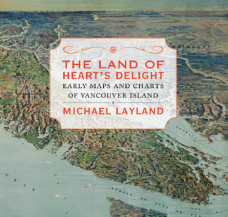
The Land of Heart’s Delight: Early Maps and Charts of Vancouver Island
By Michael Layland
Touchwood Editions
232 pages, $39.95
Reviewed by Margaret Thompson
In this meticulously researched and lavishly illustrated book, Michael Layland traces the development of the accurate, detailed maps of Vancouver Island we take for granted today. His own qualifications as a cartographer and historian, with a special interest in exploration and map-making, ensure that this account will more than satisfy the most exacting academic and scientific scrutiny, but rest assured, that does not mean it would appeal only to scholars. What this book does, in terms that even those with the most limited acquaintance with maps can follow, is to conjure Vancouver Island almost literally out of thin air.
Near the end of the book, Layland refers to the work of the anthropologist Franz Boas, and shows a long list of traditional Kwakwaka’wakw place names Boas collected which demonstrate the First Nation’s intimate knowledge of the coast where they had lived for centuries. By contrast, the earliest European visitors to the North-West in the sixteenth century were venturing into completely uncharted territory, armed only with rumour and speculation and their own courage. The earliest maps of the region reflect this tenuous grip on reality: fragmentary pieces of unattached coastline, possible straits, rocks and mountains covered with tiny hand-drawn trees, straggling lines that peter out when circumstances forced the explorers to turn back. At the time, those early mariners did not even realize they were travelling beside an island, and thought they were mapping the mainland.
Readers of this book are in much the same position as the very earliest visitors. The island is hidden at first, but as the author leads us through the centuries, its outline becomes more defined, its intricacies more exactly delineated, its salient features given lasting names, each successive map and chart visibly more accurate and reliable, until the familiar outline emerges. Nor is that the end of the process, for the interior of the island remained an unknown quantity for many years, and the surveyors’ maps of areas of development are just as fascinating as those of the ocean-going explorers.
What is immediately obvious from the author’s entertaining narrative is how much history, how much human experience, is concentrated in these two-dimensional representations of a three-dimensional world. The maps are the products of a variety of motivations: curiosity, the search for a Pacific entrance to the fabled north-west passage, politics and jockeying for power, diplomatic missions, trade, gold, farming, colonization. The maps also immortalize the people involved in their making, for it was as commonplace for explorers and surveyors to name the straits and bays and islands and hills they discovered after themselves, their colleagues, and their vessels, as it is for a botanist to add his name to a new species. So Layland shows that in the very names familiar to all Island dwellers, and easily located on any modern map—Haro, Juan de Fuca (who was actually Greek), Vancouver, Broughton, Meares, Mayne, Baker, Pandora, Cormorant, Quadra, Gabriola, Pemberton, to name just a few—lies the whole history of European involvement in “the land of heart’s delight” at the edge of the world.
Margaret Thompson’s new novel, The Cuckoo’s Child, is being published this spring.

{ 0 comments… add one now }